Basic HTML Version


Ecrin v4.12 - Doc v4.12.02 - © KAPPA 1988-2009
Rubis Guided Session #1
• Rub
GS01 - 7/33
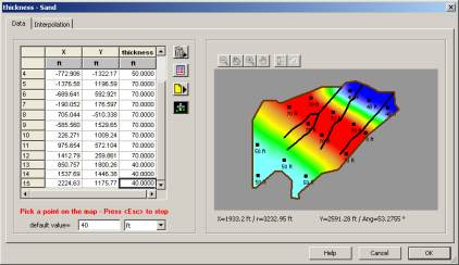
Fig. B02.6 • Defining the data points for the Sand layer thickness
Click on OK to validate when a sufficient number of data points have been picked to reproduce
the desired trend.
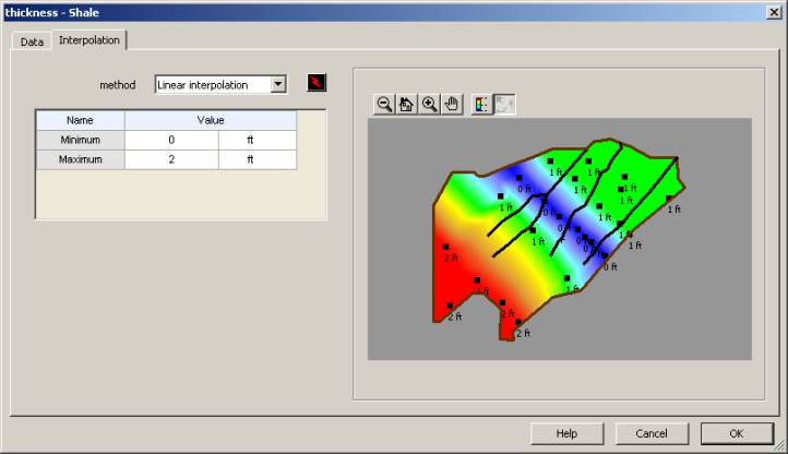
To finish with the layers definitions, we are now going to load the thickness of the Shale layer
from the “RubGS01_ShaleThickness.asc” file. Change the thickness type from “Constant” to
“Data set”, and load the corresponding data as already performed for the top horizon of the
Sand layer. In this case also we will keep the default interpolation method (linear):
Fig. B02.7 • Changing the interpolation method for the Shale layer thickness