Basic HTML Version


Ecrin v4.12 - Doc v4.12.02 - © KAPPA 1988-2009
Diamant Guided Session #2
•
DmtGS02 - 1/11
Diamant Guided Session #2
A01 • Requirements
Diamant has the ability to load automatically DMP2 multiple wells production data sets. The
DMP2 format is an ASCII format originating from Dwights Detail Production Export format.
The object of this guided session is to use this feature of Diamant to illustrate how production
data can be displayed, plotted and manipulated on a well to well and field wide basis.
The session uses the files DmtGS02.dp2 and DmtGS02_contour.txt copied during the Diamant
installation and located in the Examples subdirectory.
It is assumed the user has already followed and completed the Diamant guided session #1.
B01 • Creating a new Diamant project
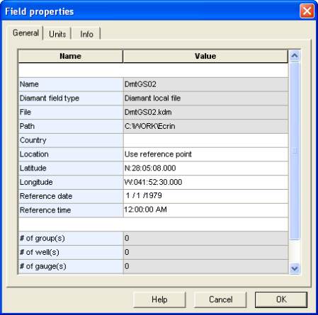
Launch Diamant standalone or through Ecrin workstation and create a new field by clicking on
or the file menu 'New'. Let’s call the field 'DmtGS02' with reference date
01 Jan 1979
and
coordinates of the reference well in decimal degrees
N28.05.08 W41.52.30
.
To access the option 'use reference point (decimal degrees), click in the Location field, choose
from the combo box the required option and input the information. To access the 'W'
Longitude, highlight 'E' and type 'W'. See Figure B01.1.
Fig. B01.1 • Field properties
Click OK, the browser now shows the added nodes of field 'DmtGS02',
'Technical Objects' and the '2D Map'. Click on the node
in the
browser to display the default 2D Map (square reservoir), double click
on the contour in the 2D Map to access the 'Field contour' dialog.